3rd Stage
San Marino Città (RSM) - San Leo (RN)
Piazzale Domus Plebis - 47890 Città di San Marino, San Marino

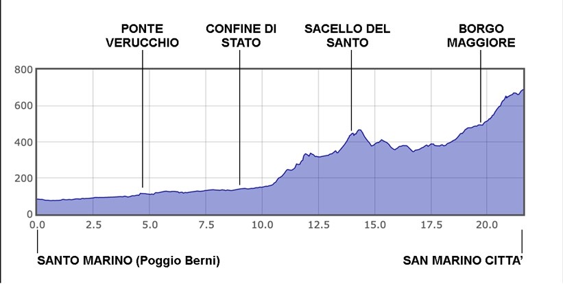
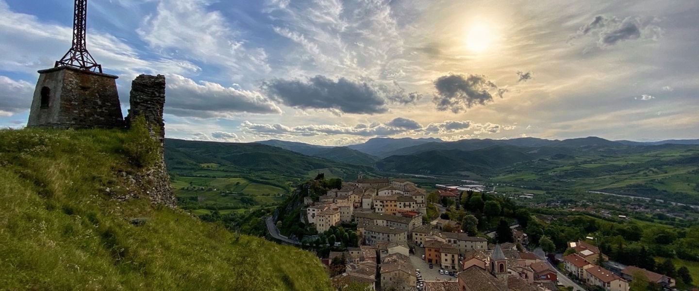
The second day is certainly the most challenging of the entire Camino, as the goal is to reach the summit of Mount Titano, in the heart of the Republic of San Marino, where the capital of the small state stands: San Marino Città.
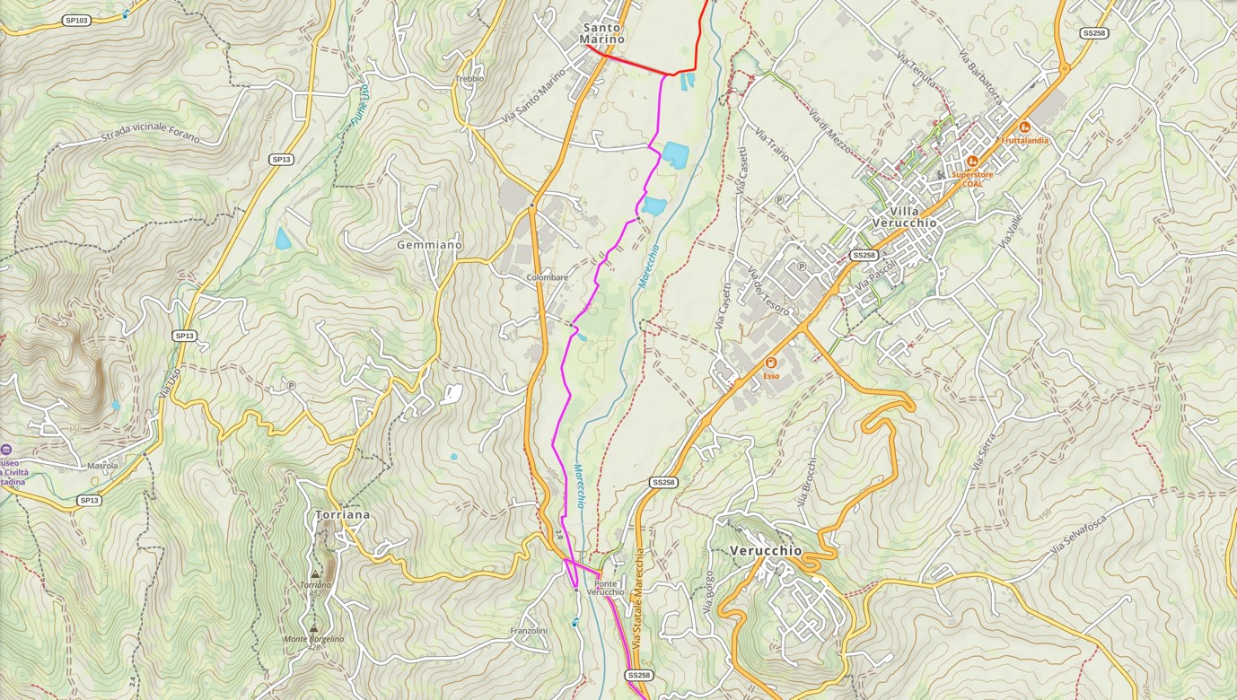
First of all we have to retrace the last part of the previous stage to return to the cycle path which, taken to the right, will allow us to continue our ascent of the Marecchia river. The route continues on a gravel surface for a few kilometres, up to the end of the cycle path in Ponte Verucchio. Here you have to turn right, as if to go back, along the paved road, in order to cross the river on the road bridge. Be very careful, as this stretch of road is very busy, especially on working days.
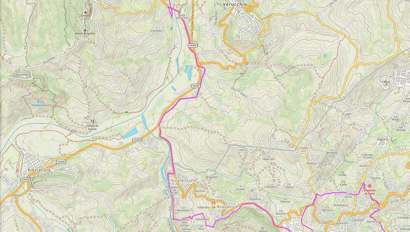
After crossing the bridge, we will find ourselves in front of the remains of the old railway tunnel of the Santarcangelo-Novafeltria line and, turning right along the main road, we will reach the center of Ponte di Verucchio. From here, continue along the main road, bordered on the left by the brick wall of the old railway, until you reach a large roundabout. As soon as you pass it, keeping to the right, you will find some pedestrian crossings which will lead you to a much smaller paved road with almost no traffic, Via Dogana. The road ends at a roundabout decorated with a large butterfly, not far from the Italy-San Marino state border.
Here we will keep to the left, following the signs for San Marino and we will travel along the roadside for about 1 km, until we cross the border of the Republic of San Marino, indicated by a large stele (Stamp 3). After crossing the border, after about 200 meters, we will turn right following the signs for the Gualdicciolo industrial area, thus, after the first bend, we will arrive at the beginning of the cycle path that runs alongside the San Marino stream, visible on our right.
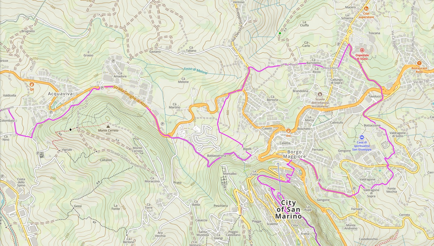
After about 1 km, a sign tells us to leave the cycle path to take a paved road called "Strada Molino Genga", from here our real ascent towards Mount Titano will begin. It will be necessary to skirt the steep road until it ends on another road, we will turn right and after a sharp bend, we will proceed to the right, for "Via del Mercurio".
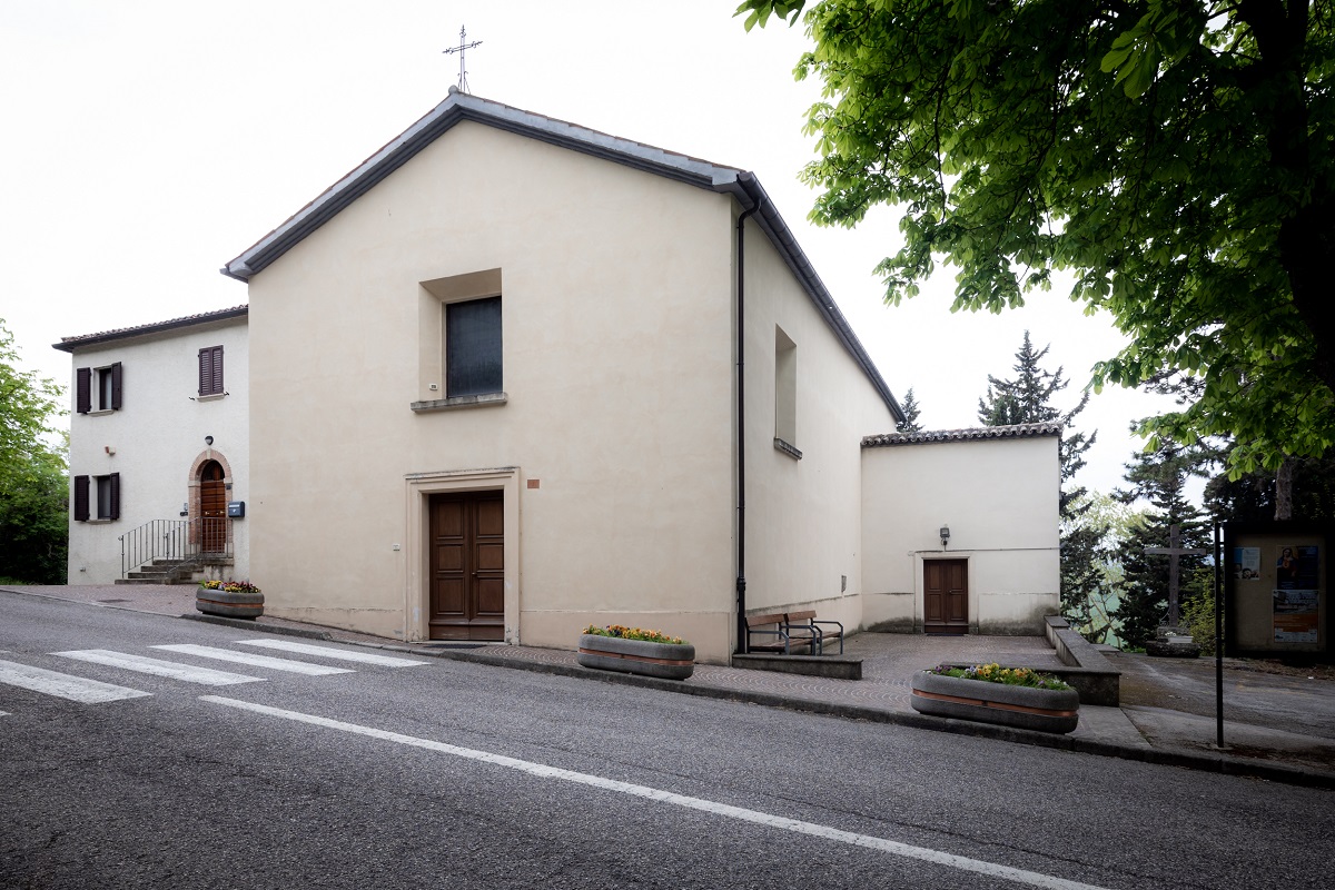
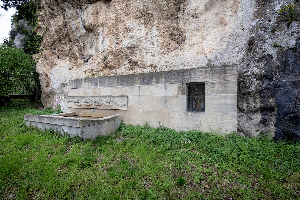
After only 200 meters we will take a road on the right, "Strada del Colombaro", which will lead us to "Strada Molino Magi", continue uphill on the left and after a few meters we will find ourselves on the back of the Church of Acquaviva (Stamp 4), important place because, according to tradition, here Saint Marinus baptized through the spring that flowed up from the rock, today embellished by a modern fountain. Great place to find some rest and refreshment.
Resuming the Walk, looking at the facade of the church, we will continue to the right and immediately turn right, skirting the rock face. After a while, staying close to the mountain, we will have to take a gravel road, before the bowling alley, which leads to very shady climbing cliffs, thus avoiding the main road. We will always have to keep to the left, skirting several houses.
We will thus arrive at a large parking lot, which we will cross completely, and we will take the flat main road, keeping the same direction, with the mountain on the right and the factories on the left. After 500 meters, always keeping the same main road, white-blue trail flags will appear indicating that the Cammino del Santo Marino overlaps the Cammino del Titano. Continuing straight you will reach a large roundabout, where we will leave the main road to take the "Strada della Baldasserona", in front of us, where we will continue to climb.
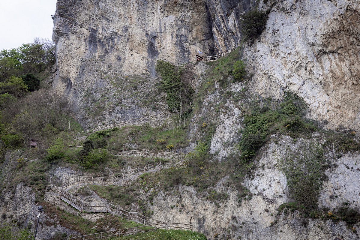
After 500 meters of ascent, we will find ourselves in the shadow of a high rock wall, on the top of which is the Sacello del Santo (Stamp 5), the first place that hosted Marinus and where, by tradition, he founded the Republic.
From here it is always necessary to proceed uphill, along the same road, until you reach the Baldasserona car parks where, near the houses, we will find a pole with signs.
*variation for bikes
Continue following the signs for the Cammino del Titano in the direction of Borgo Maggiore, then drive along the highway and, at the roundabout, turn right following the main signs for the Old Town of San Marino City, arriving at the end of the stage.
Here, pilgrims will be able to choose whether to continue the stage, covering 5.5 km visiting the Marian places of the Republic (Marian path) or to cut and reach Borgo Maggiore directly.
MARIAN PATH
At the post with the signs, all you have to do is continue to follow the signs for the Cammino del Santo Marino, then turn left and descend towards Ventoso (see signs for the Cammino del Titano). This stretch is rather rural, with a 500m stretch with a path that is not always defined due to the intervention of the farmers. We will descend having the fence of the motocross track on the left and the houses on the right, we will arrive in the woods where a small bridge simplifies the crossing of a ditch and, crossing the field that we will find in front of us, we will skirt the houses on the back, until we reach the paved road.
Arrived at the main road, crossing carefully (given the 3 lanes of traffic) we proceed on the right and at the first crossroads on the left. We continue on the main street of Ventoso and, following the signs, we take a dirt road on the right, which descends steeply into the ravine and takes us back to the paved road in the locality of Ca' Riccio. Here we continue to the left and immediately straight, leaving the white-blue path of the Cammino del Titano.
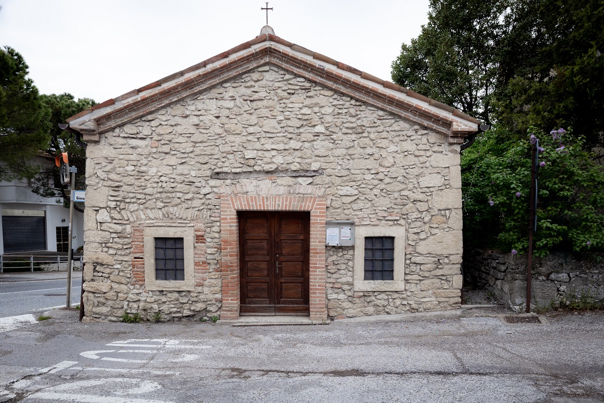
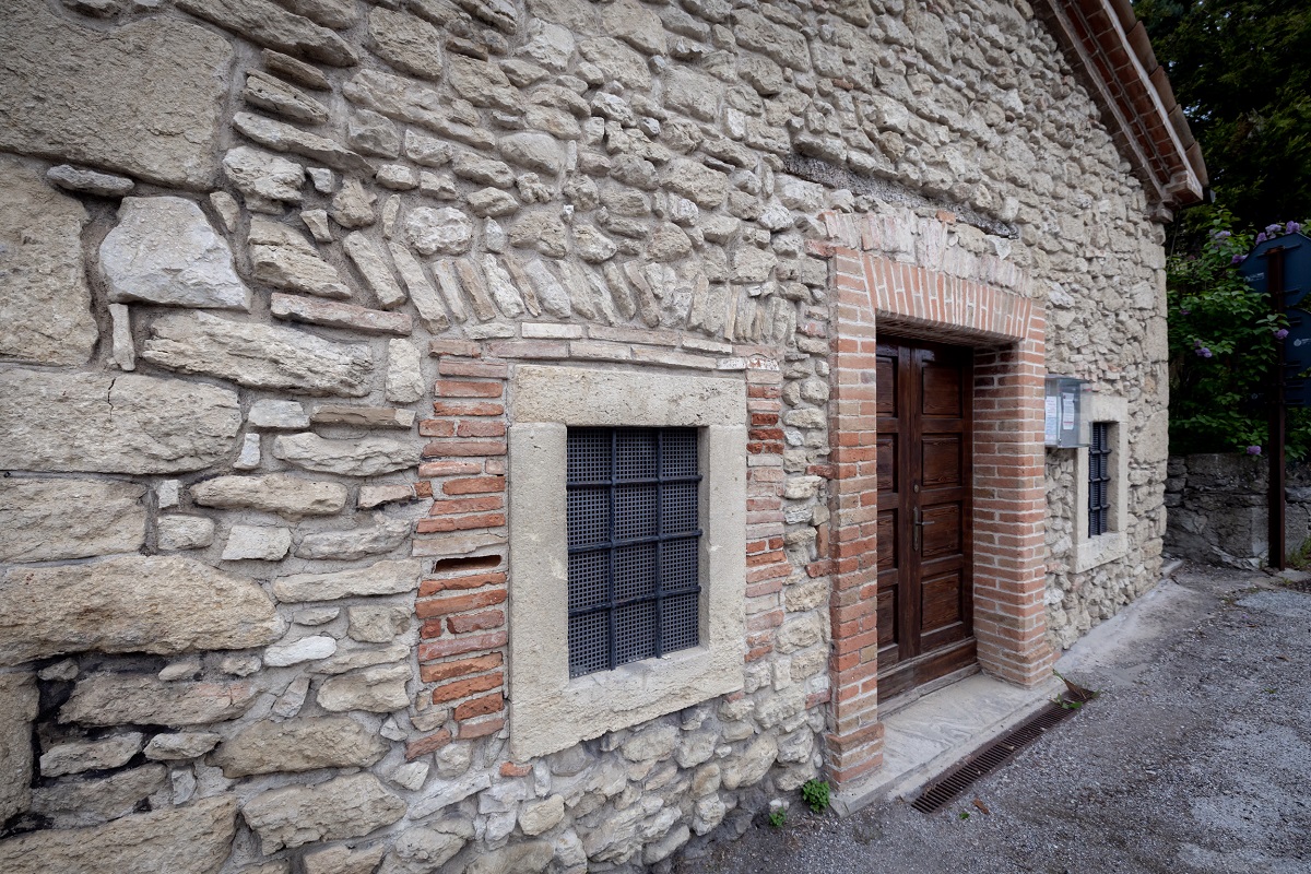
The paved road, quite flat, will lead us to cross the steep main street of Cailungo, beyond which we will meet the small church of San Rocco, inside which we can find a painting depicting Mary and Jesus, with San Marino and San Rocco.
We continue straight ahead and at the first crossroads we keep to the left going down steeply to the end of "Via Messer Franceschino", where we continue to the right.
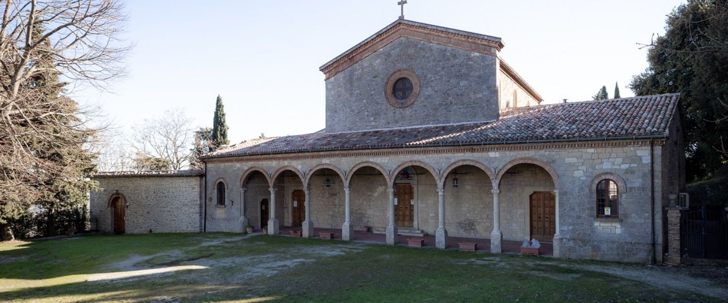
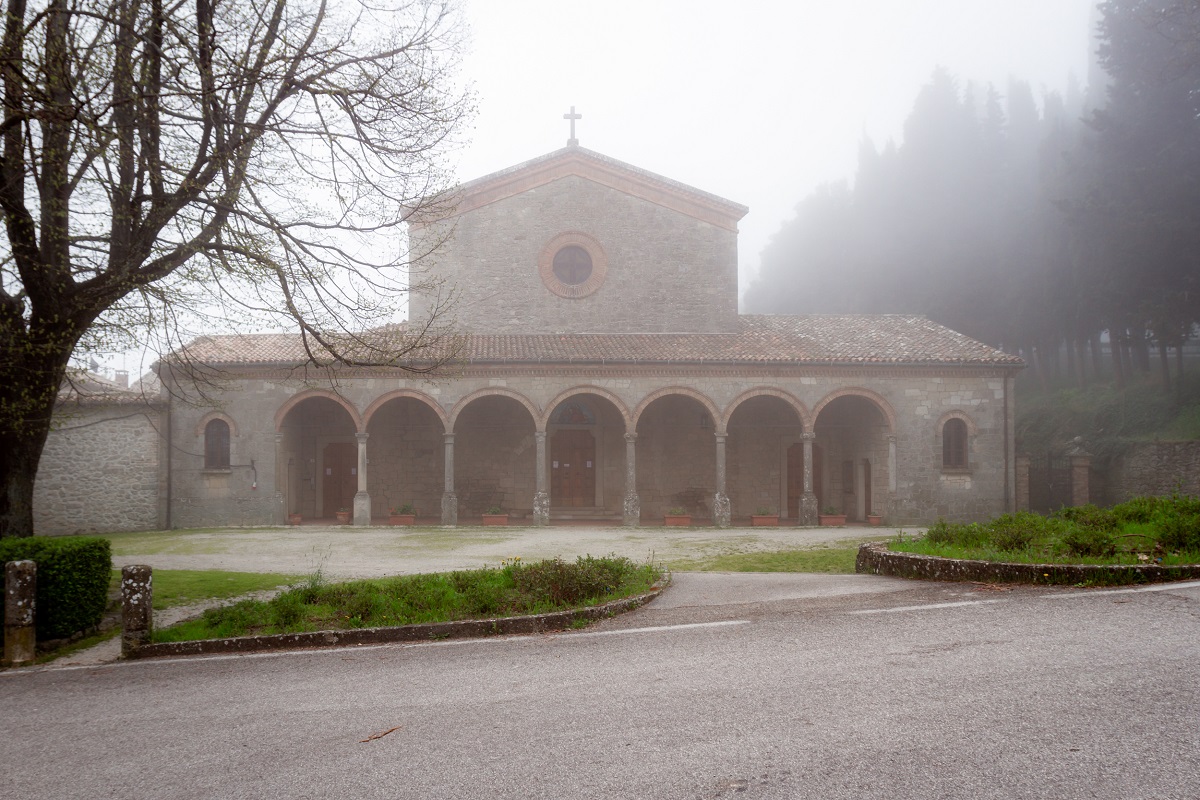
Once you reach the highway overpass, cross it and turn right, until you reach the Santuario del Cuore Immacolato di Maria (Stamp 6) after a few hundred meters, a Franciscan sanctuary with a beautiful park that surrounds it. It is possible to cross the park, skirting the imposing church on the left and exiting on the opposite side, near the Monastery of Santa Chiara, a cloistered female monastery.
Passing alongside the gate of the monastery, we continue on level ground along "Via dei Canneti" and at the first crossroads we keep to the right, climbing uphill to the Cantina San Marino, where we turn left, cross the main road and take "Strada Serrabolino". We will go up this road, crossing the ghetto of houses of Valdragone di Sopra and we will find ourselves in front of a soccer field. Turning right, and skirting the campo, we will immediately turn left into a small uphill road, until we reach a large stone church, with a beautiful portico on the facade, called the Chiesa dei Servi di Maria.
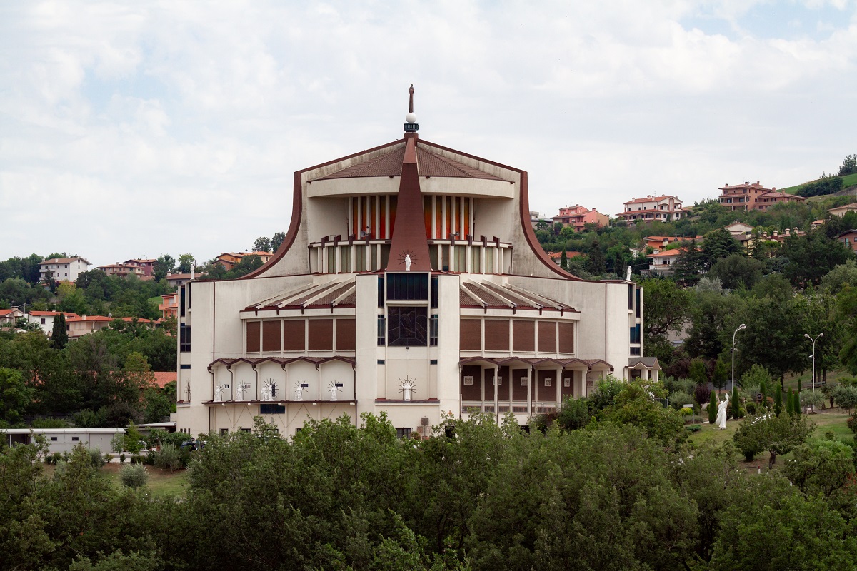
From here, with the church behind us, we will proceed to the left along "Via Giorgio Ordelaffi", an almost flat road that will lead us to the Sanctuary of the Madonna della Consolazione (Stamp 7), parish church of Borgo Maggiore, as well as a work of art of the architect Michelucci. We will find it on the left and it is an unmistakable building, entirely built in reinforced concrete and covered by a copper roof.
On the right of the church there is an underpass that allows us to cross the highway and, as soon as we exit on the other side, proceeding straight we will arrive at the entrance to the cable car station. Without entering, going up the external stairs on the left, we will reach the Old Town of Borgo Maggiore.
END of the MARIAN PATH
VARIANT TO THE MARIAN PATH
If you don't want to take the whole stage, including the Marian path, you can follow the signs of the Cammino del Titano (white-blue trail) in the direction of Borgo Maggiore, reaching the cable car station in a few minutes.
Once in the main square of Borgo Maggiore, we will find on the left the Church of Sant'Antimo (Stamp 8), custodian of the relics of Saint Agatha, co-patron saint of the Republic.
To continue with the Walk, keeping to the right of the square, we climb upwards and when we reach the trail signs, we take the Costa dell'Arnella, an ancient road that connected the towns of San Marino Città and Borgo Maggiore. We will follow it up to the Chiesina del Crocefisso, after which we turn right continuing on the level through the parking lot and we will reach the main road that runs along the outside of the city walls.
*end of variation for bikes
We go up, we reach the main gate of the walls and, still going straight, we will turn left after a hundred meters, along "Via Paolo III", meeting the Chiesa dei Cappuccini. We will continue along the road, on the left, to enter the walls near "Piazza Sant'Agata", cross it and, continuing straight, we skirt the Church of San Francesco (Stamp 9 and Certificate), until we find ourselves in front of the main facade. This is the oldest existing church in the Republic of San Marino.
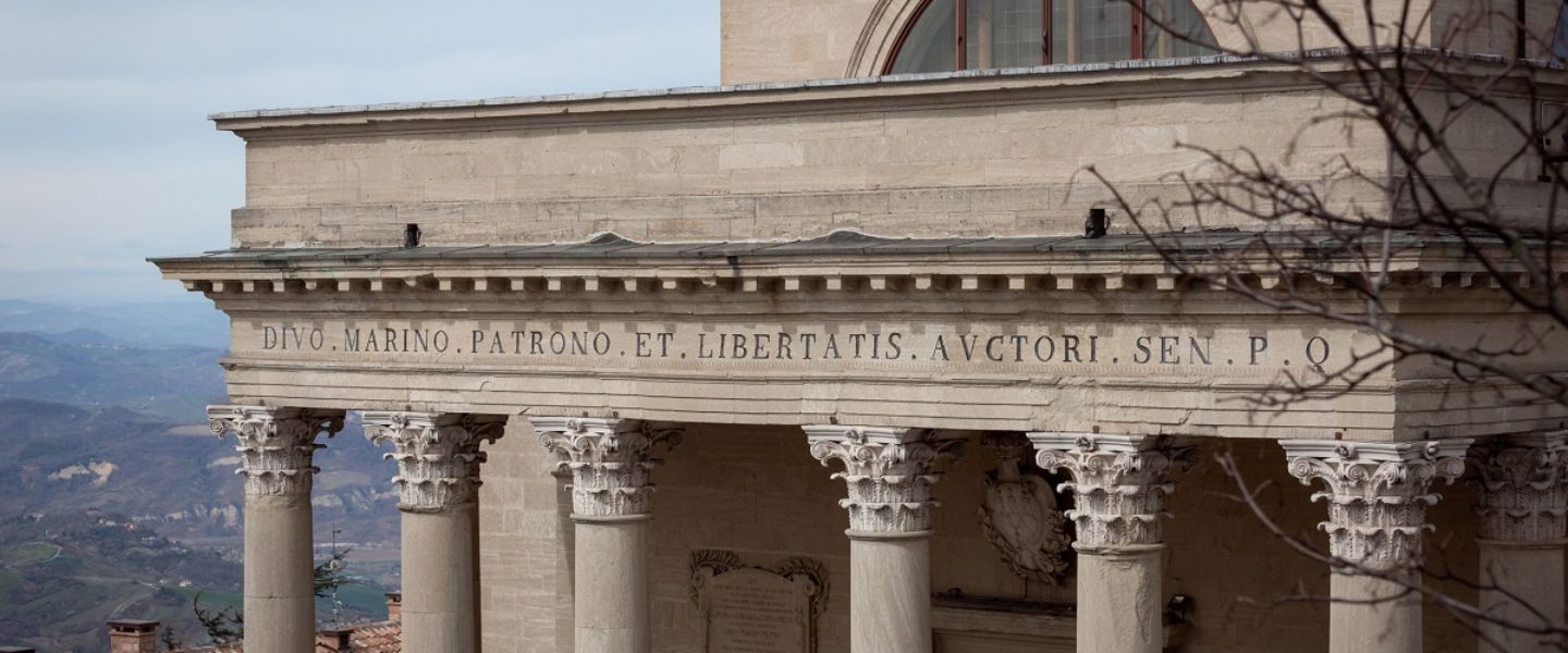
Continuing uphill in the Old Town, we will pass from the "Piazzetta del Titano" to the Caffè Titano for Stamp 10, and the second stage ends at the Basilica del Santo (Stamp 11).
Useful numbers for food and accommodation
Tourist Information Office of the Republic of San Marino
+378 0549/882914
+378 0549/882575
www.visitsanmarino.com
info@visitsanmarino.com