
3rd Stage
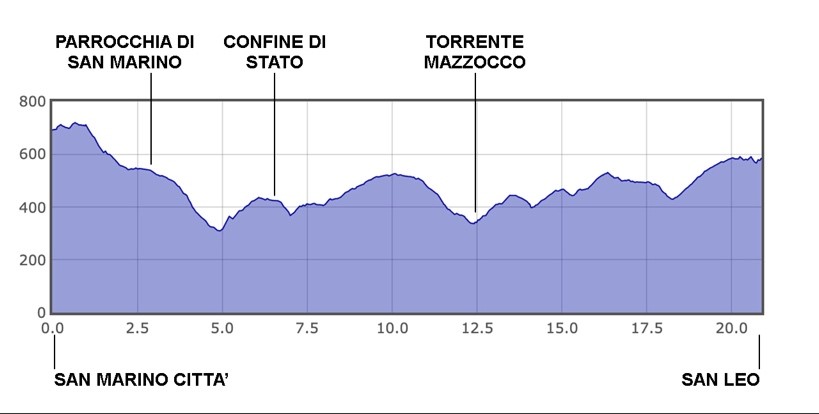
San Marino Città (RSM) - San Leo (RN)
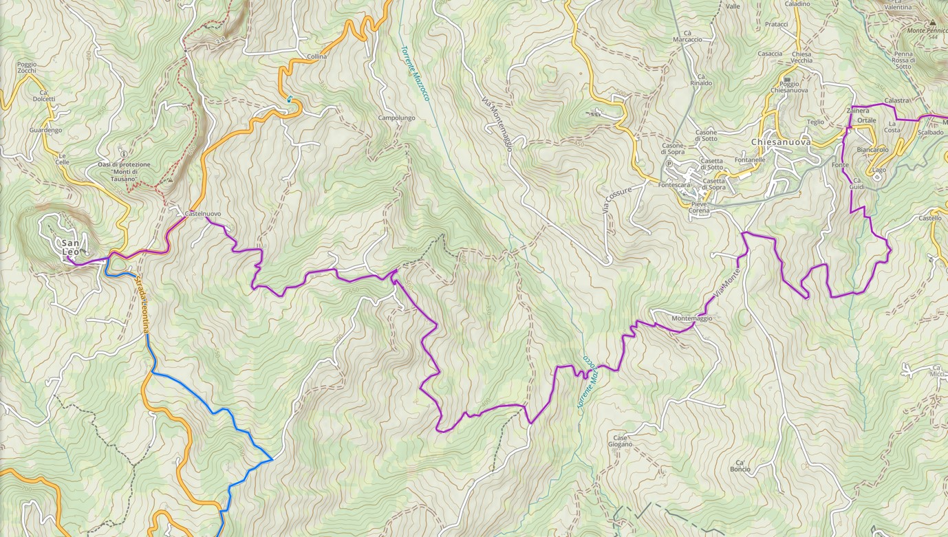
We have reached the third day of the Walk, the beginning of the more natural and rural part of the pilgrimage.
*variation for bikes
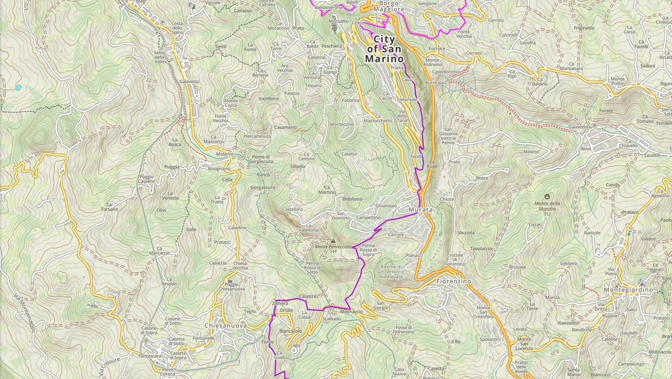
From the main gate of the Old Town, "Porta San Francesco", you need to head to the left, skirting the walls flat and always following the main road that leads to Murata, to reach the parish church. [for GPS: Chiesa Parrocchiale dei Santi Pietro, Marino e Leone in Murata].
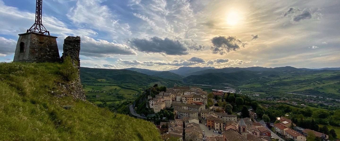
From the Basilica del Santo we follow the signs for the Prima Torre Guaita in order to reach the highest part of the mountain and, in the direction of the Seconda Torre Cesta and Terza Torre Montale, we will cover the entire ridge, with the Apennine mountain range on the right and a fantastic sea view.
Having reached the Terza Torre Montale, the path will begin to descend to the right, on a steep pavement with a rocky bottom, mixed with ground which will lead us, with a small parenthesis on the paved road, to Murata. Once on the main road, near a petrol station and a large roundabout, we follow the trail signs to arrive at the headquarters of the Parish of San Marino (Stamp 12), the Salesian center of the Republic. The last stretch before reaching the church passes through a rural and wooded area, BE CAREFUL when turning to the right, above a retaining wall.
*end of variation for bikes
Leaving the church on the left, we will continue straight along the road, going down to the left and shortly after we turn left
*variation for bikes
Do not turn right into Via Pennarossa, but continue straight on until the end of the road. Then turn right and continue on the main road for a couple of km. At the roundabout, follow the signs for Chiesanuova and go down the main road as far as the bridge over the San Marino stream. Continue up the main road, reaching the village of Chiesanuova. At the state border, turn left and follow the signs for Monte. [on GPS: Church of Monte, via monte 21, San Leo]
and then immediately right, going down a paved road (Via Pennarossa), which will end in front of a ruin. Here the route continues to the left, taking a dirt path that descends steeply and enters the woods. We will emerge after 1-2 km on an asphalt road, we will turn right and, after crossing the road bridge over the San Marino stream, the route will continue to the right, uphill, along a dirt path.
The path will become a gravel cart track, near a farm shed, and will lead us onto another paved road. We will turn left and, after a hundred meters, cross the main road, taking "Via S. Serafini". Immediately afterwards it will be necessary to turn left onto "Strada Ca' Guidi", going slightly downhill. We will come across an agricultural shed on the right and shortly after the road will curve slightly to the left, we will have to continue straight on a dirt path. WARNING, if you arrive in the courtyard of a house, or the paved road becomes gravel, you have gone too far.
Here we are definitively leaving the Republic of San Marino, crossing a secondary border, not marked with portals, signs or flags of any kind. From here on, the journey continues entirely in Italian territory.
The path descends steeply in the middle of the woodS and, after crossing an old bridge, it climbs up leading us to the paved road in Valle Sant'Anastasio, where once, near the current cemetery, stood the ancient abbey, of which we can still appreciate the wall remains.
We will continue to the right along the road, with little traffic, uphill for about 3 km, until we reach the ridge pass, where we will have to turn left and then immediately right, downhill, skirting a cemetery with a curious pyramid-shaped building. We continue for 1 km downhill to the Chiesa di Monte, a pink structure on the right of the road.
*end of variation for bikes
Just before it, we take the road on the left and, immediately after, we continue straight along the gravel road, only to find ourselves once again on asphalt after approximately 500 metres.
We turn left and go down to the road bridge over the Mazzocco torrent, to continue on the same uphill road, on the other side of the riverbed, for another 1 km. We will then take the first road on the right that we will meet, with a gravel surface, starting a beautiful panoramic and rural stretch. At the next crossroads, near an ancient well, we turn left and continue walking on the gravel track. From here on, you just have to pay attention to the turns marked with trail signs, following this road for about 6 km, reaching the main road a short distance from our destination.
We will arrive on the provincial road near a beautiful stone church and a votive cell, which we will find opposite, on the other side of the road. We continue to the left along the main road, we pass the large parking lot for campers and, following the signs and the good visibility that opens towards the Rocca, we reach the center of San Leo (Stamps 13 and 14) and end the third day of walking.
Useful numbers for catering and accommodation
IAT Tourist Office - San Leo
+39 0541/916306-926967
info@sanleo2000.it
www.san-leo.it
Suggested events
Tourist attractions nearby